
Route Details
-
Difficulty:Intermediate Paddling
-
Distance:50 km
- Duration: 4 days
- Route Type: Exploration
- Camping: Yes
Summary
Put this epic on your list of Canadian adventures. This multi-day adventure will take you well away from the crowds and into the tranquility of the Southern Gulf Islands with relatively little effort.
Whilst the Gulf Islands themselves are incredibly popular with tourists throughout the year, the waters between them are vastly under-explored. Jerome, Ayelen, and I spent nearly four days kayaking the Gulf Islands on an August bank holiday and saw only a handful of other people.
Navigation
-
Phone signal in BC is not reliable. Always carry an offline map. I recommend and use AllTrails+ for hiking or GaiaMaps for general adventuring. Google Maps does not always have reliable route mapping for backcountry adventures.
Don't Miss
Bioluminescent plankton are not rare, but the conditions required to see them can make them hard to find. The plankton are active all year round, in much of the coastline around the Gulf Islands. But to see them, you'll need almost complete darkness. Here are a few tips to maximize your chances of seeing them:
- Venture out onto the water when there is no moon
- Better still, a cloudy night will ensure more complete darkness
- Stay away from towns that will cause significant light pollution
- Find a dark corner of a bay, under cover of trees
- The calmer the water the easier it is to see the plankton below
- Ideally, turn your head torches off. If you really need a little light, use a red light mode as it won't impair your night time vision.
Conditions & Ability
Paddler Ability Kayaking is open to all levels, and it's certainly possible to do a kayak camping trip in the Gulf Islands with relatively little experience. That said, be sure to plan a trip that suits your experience level. Beginners Consider honing your kayaking skills in and around Montague Harbour, or by joining a guided tour from Gulf Island Kayaking. Montague Provincial Campground is nearby and offers a good option for those who want to stay nearby. I would not recommend venturing out into the Trincomali channel and the other gulf islands if you have no or only little prior experience. Intermediates The nearest and most reachable campground outside of Montague Harbour is located at James Bay on Prevost Island. With a little planning and discussion with Gulf Island Kayaking, this 2km crossing from the outer edge of Montague to Prevost shouldn't be too difficult, in the right conditions. Advanced If you are an experienced paddler, your options are endless. Regardless, be sure to discuss your plans in detail with the rental shop if you wish to use their kit. The Trincomali Channel is about 4km at it's widest point, which can take a good hour and a half to cross. That's a serious amount of water to cross - so choose wisely. Tides & Currents Certain areas in and around the Gulf Islands have a reputation for strong tides and currents, strong enough to put you in serious trouble. However, it is very possible to avoid the times and locations of these strong currents and remain in relatively safe waters. Generally, the strong currents occur between the tightest gaps in the islands, especially those nearest to the Straight of Georgia. In particular, this means between Mayne & Galiano Islands and between Galiano & Valdes Island. The incoming tide travels northwest through the Straight and filters into the various channels and waterways. It's imperative that you understand the geography of the area and the timing and strength of the tides before you embark on
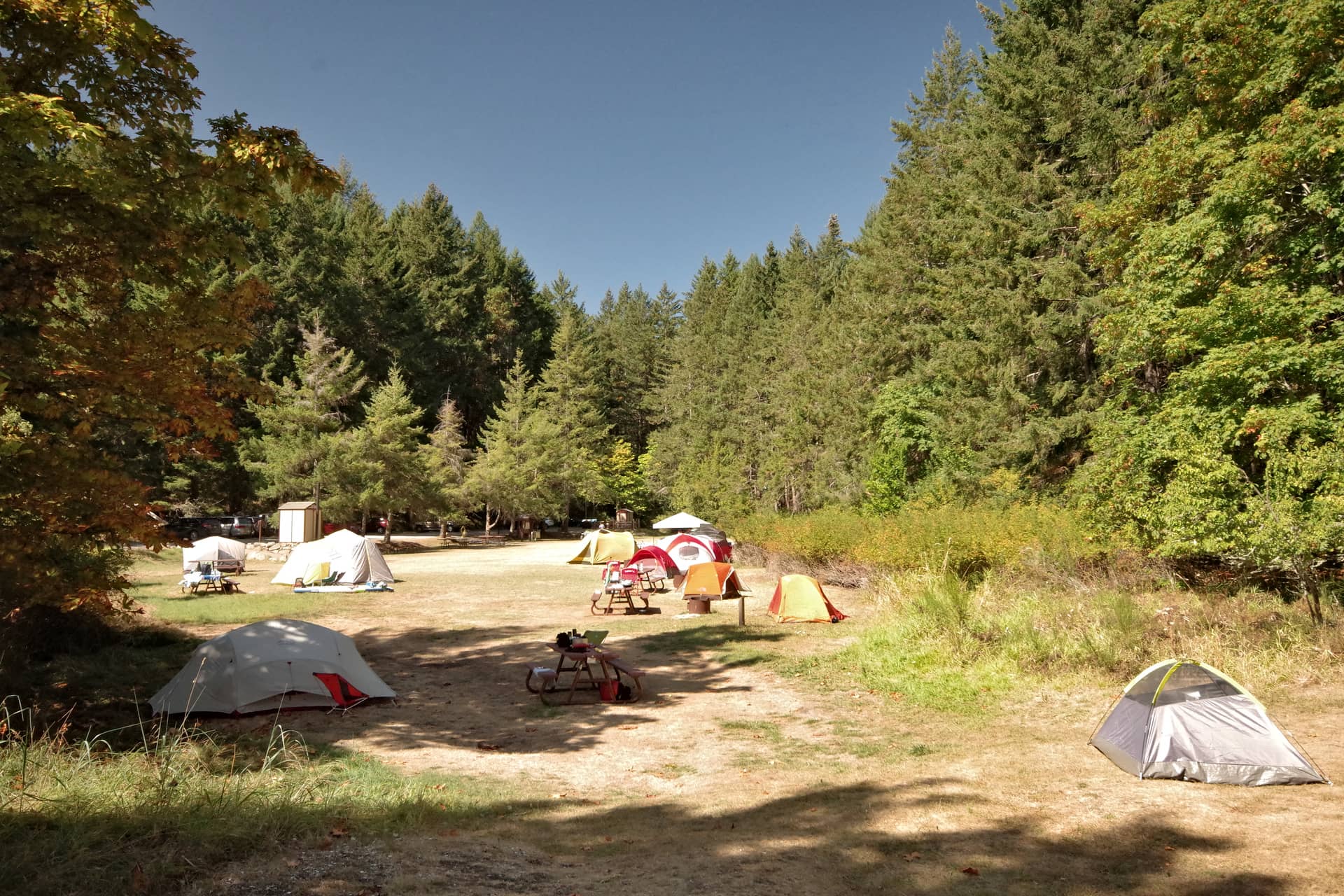
Camping
-
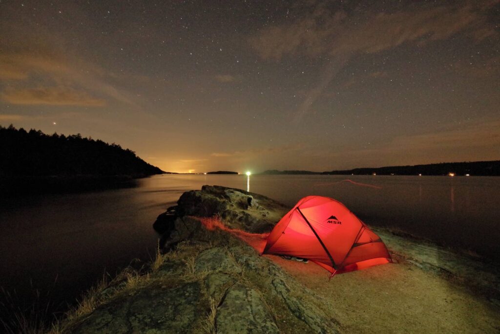
Unfortunately, most of the terrain on the Southern Gulf Islands is designated as private land. However, the are a number of designated campgrounds that allow you to stop over each night. Below is a map of the available campgrounds, most of which are first come first served. First come first serve campgrounds are not my favourite. They seem like a daft concept, especially when you sometimes have to travel or kayak for a couple of hours to reach them. It's not always practical to move onto the next campsite, which might be another hour or so down the coast. With that in mind my advice is to be pragmatic, and courteous to your neighbours. Others have likely come to the Gulf Islands to enjoy the peace and quiet, so pitch up somewhere that causes minimal intrusion to others that are already there. Keep the noise down and perhaps offer them a beer! In my experience, other paddlers are very understanding of the campground situation and will be very accommodating if you practice basic campground rules around noise and litter. Chivers Point Campground - Wallace Island Space for 15 or so tents on designated spots. First come first served No facilities Walter Hook Beach - Saltspring Island Not technically a campground Great location if no wind You need to be sure about the high tide level No facilities Wonderful despite all of the above! Walter Hook isn't technically a campground, but the beach has a public right of way, which means you can access everything below the high tide level. Anything above this is deemed private land. With all but the highest tides, pitching a tent just below the masses of driftwood shouldn't be a problem. We waited until the 10pm high tide before pitching our tent as we weren't sure where the water would reach (note: your hide tide time will differ). James Bay Campground - Prevost Island Plenty of open space Very few people Orchard with tasty fruits Only 4km from Gulf Island Kayaking This delightful campground has plenty of open space and is even fl
Suggested Season
- Months: May - Sep
Location & Access
- Region: Southern Gulf Islands
- Fire Region: Coastal Fire Centre
- Vancouver Day Trip: No
- From Vancouver: 2hr(s)
- Public Transit: Yes
Getting There
-
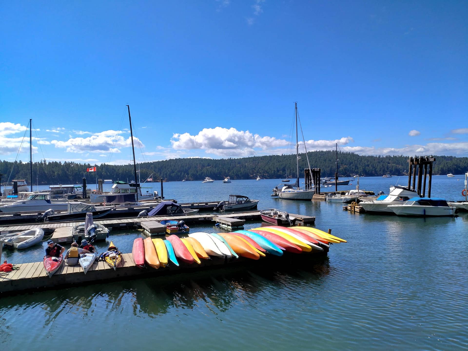
If you have your own kayak, you have endless options of where to begin your trip. For those of you that need to rent touring kayaks, I recommend you start at Gulf Island Kayaking on Galiano Island.
To reach Galiano Island, take one of the regular BC Ferries from either Tsawwassen ferry terminal or Schwartz Bay in Victoria. Park your car at Tsawassen Ferry Park & Go and take the shuttle to the ferry. Gulf Island Kayaking will pick you up from the ferry terminal - just be sure to call them in advance and provide your arrival time.
You can also reach Tsawwassen Ferry terminal by bus.
-
If appropriate to reach this adventure, rent a car, or better still, reduce the demand for cars with Evo Car Share, Vancouver's car sharing network.
Detailed Itinerary
It’s worth noting that both Jerome and I are experienced paddlers. The following itinerary covers large distances (we were helped significantly by favourable tides and winds). I provide this itinerary as ideas for destinations, and don’t necessarily suggest that you try and replicate the whole journey.
Day 1: Montague Harbour to Wallace Island - 20km
I think it’s fair to say that Jerome and I vastly underestimated the distance we were about to cover. However, good fortune meant the wind and tides were both in our favour and made the distance somewhat manageable.
The initial paddle takes you through Montague Harbour, with a mandatory pit-stop at the Montague Provincial Campground to fill up your water containers. As you exit Montague Harbour the islands open up into a huge expanse of water, just waiting for you to explore.
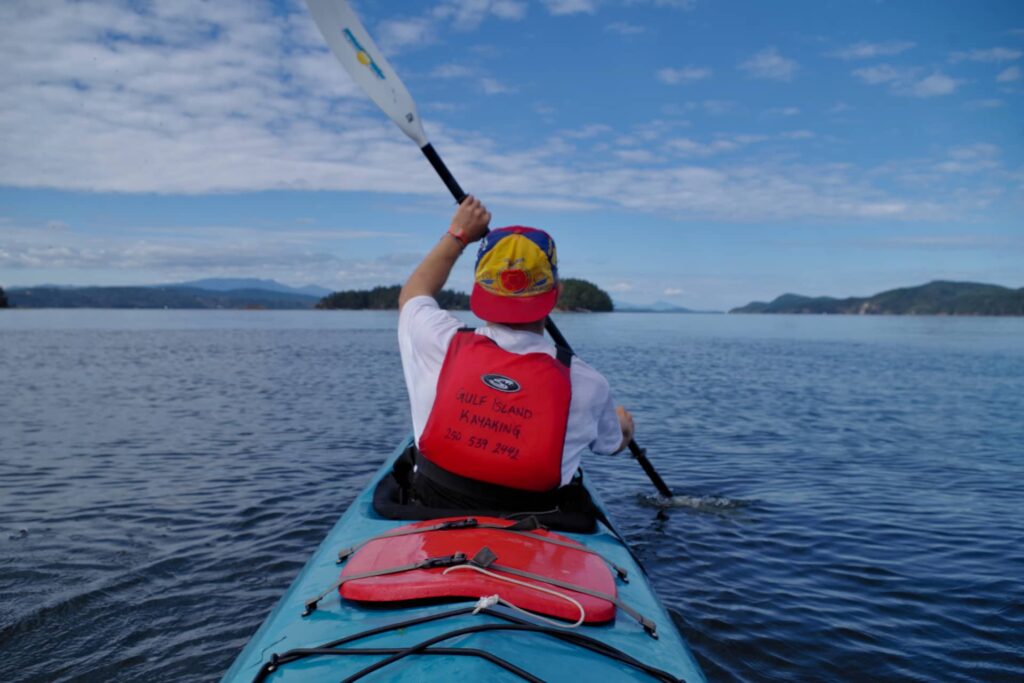
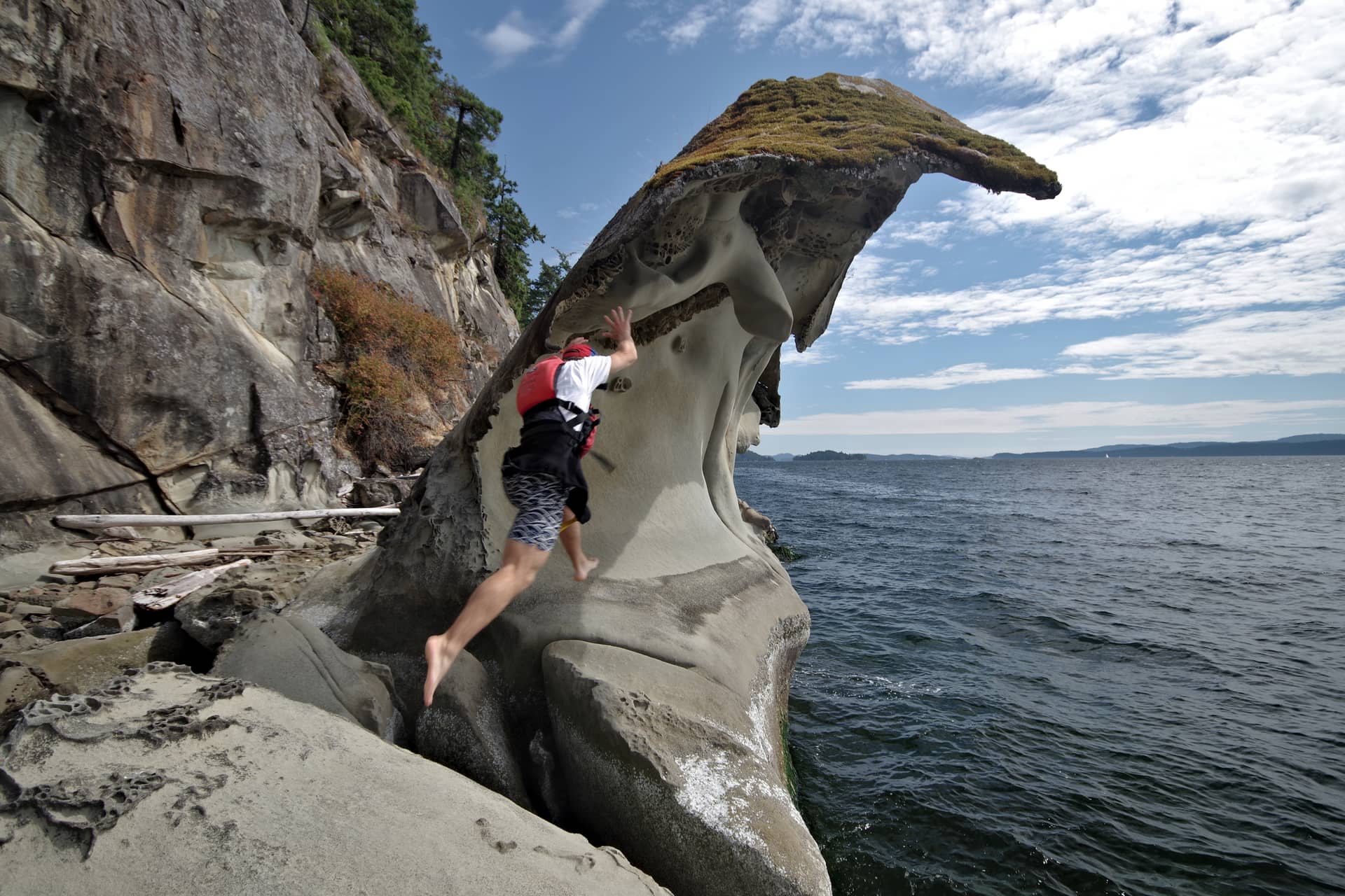
We were full of energy at this point and powering on, heading northwest and hugging the inner coast of Galiano Island. Along this coastline are all sorts of interesting rock formations that are well worth exploring if you can find a suitable landing spot.
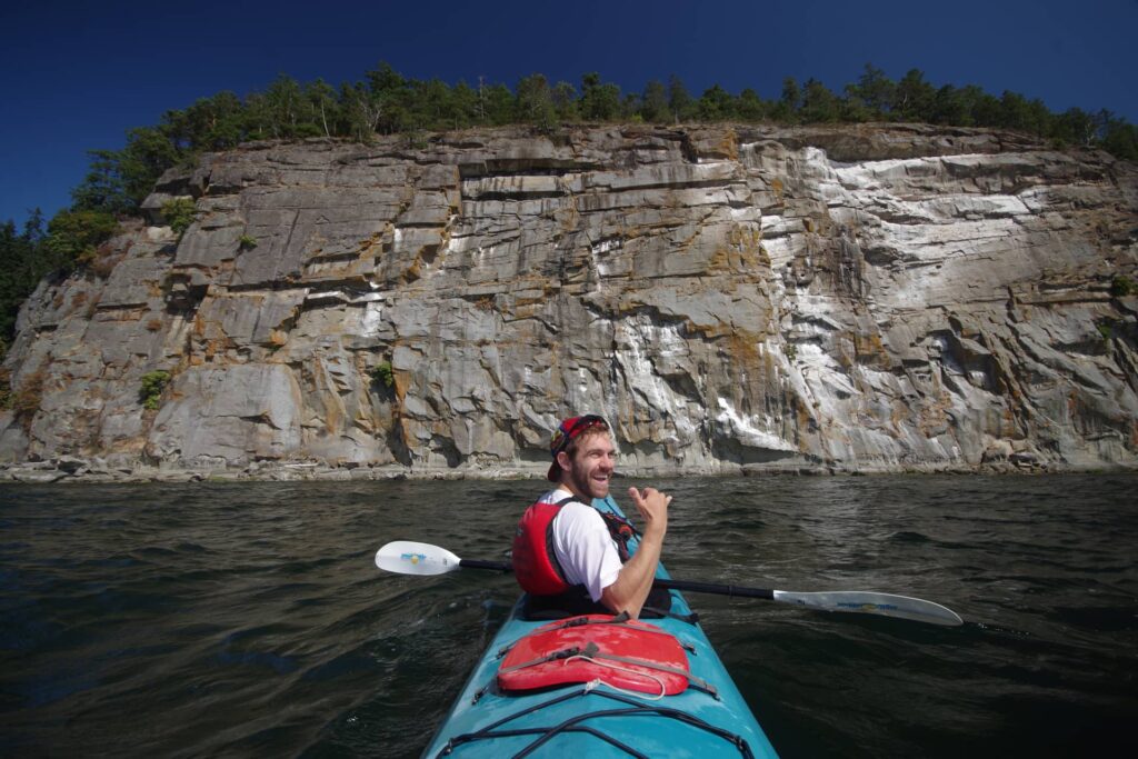
This big white cliff, not too far from Montague Harbour can bee seen clearly from the other side of the Trincomali Channel and makes a good nav marker when you’re trying to place yourself on the map.

Along the shores of Galiano Island, you’ll encounter these incredible wave like formations. If the tide is right, you might find a handy spot to tie up for lunch, though you’ll need a little luck for this.
We planned to cross the Trincomali at at southern tip of Wallace Island, where the crossing is at it’s narrowest. Even there, the crossing is 1.5 and got pretty choppy. Thankfully, the waves were in our favour and we pushed on through some fairly hairy moments to reach the eastern side of Wallace Island.
Three quarters of the way along the eastern side of Wallace Island, we stopped to look at Cabin Bay campsite. There are only a couple of tent spots here with no real options to pitch up elsewhere. Quickly we packed up and continued on to Chivers Point Campground.
It turns out Chivers Point at the southern tip of Wallace Island is absolutely the better option. It’s location on the end of the peninsula is stunning, makes a great swim spot, and is far more spacious. From there we thought we’d do a quick sunset lap of the Secretary Islands to the north, before settling down for a beer and a homemade chili.
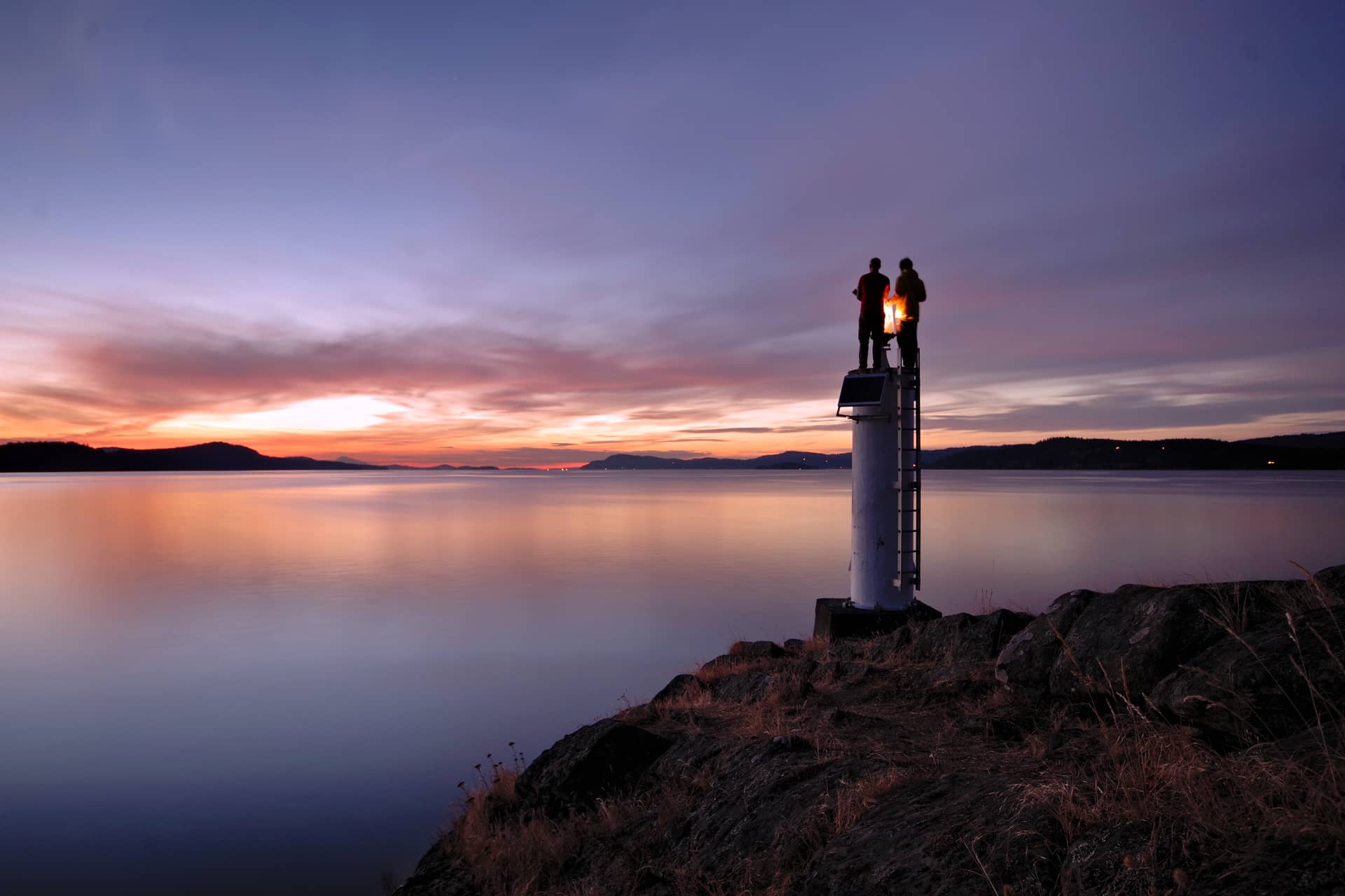
Night 1: Bio-luminescent plankton
Bioluminescent plankton was the reason I planned our first trip to the Gulf Islands. Some friends of ours had recently done a guided night kayak tour with Gulf Island Kayaking, and came back raving about this incredible phoenomenon. We had to check it out.
We re-launched our kayak at about 10pm, not really knowing what to expect. By this time the waters were calm and the choppy day time water was no where to be seen. We paddled just around the peninsula and about 100m down the eastern side of Wallace Island. Within seconds, I said to Jerome, “do you see that light?”. At first I wondered if I might have blinded myself with my headtorch and was seeing stars. We turned all our lights off and kept paddling in the almost non-existent light.
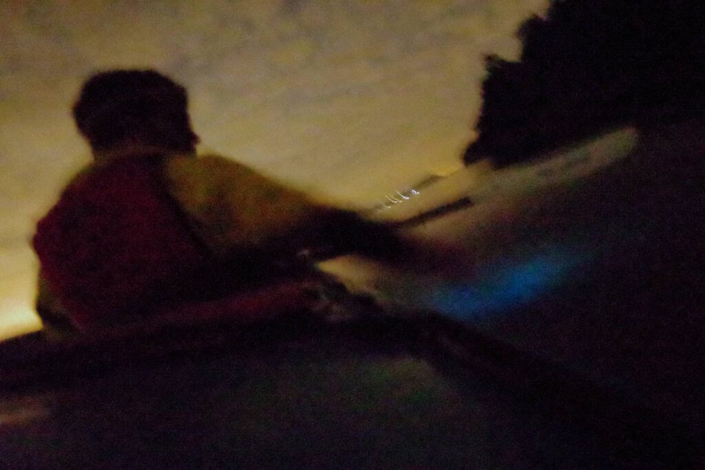
Sure enough the water beneath us was lighting up at every paddle stroke. This honestly was like nothing I’ve ever experienced. Every splash of the hand and movement of paddle, would paint magical blue stripes through the water. It got better when we paddled fast. As the paddles reached deeper into the water, fish darted in all directions, disturbing the plankton and creating an underwater light display beyond imagination.
We continued paddling around for a good 40 minutes before returning to our campsite. It’s a shame I couldn’t really capture the phenomenon with my camera, as I find it very difficult to put into words how incredible it was. Here’s about the best photo I could manage.
Day 2: Wallace Island to Prevost Island - 16km
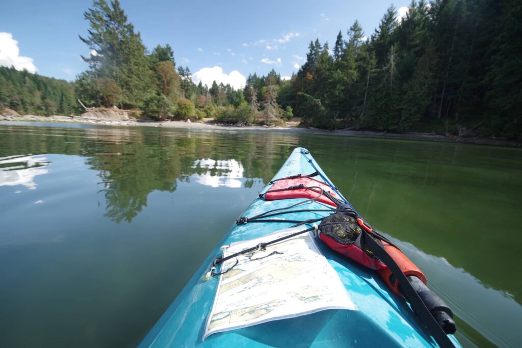
As luck would have it we again had the tides in our favour as we paddled back up the Trincomali, this time along the eastern shore of Saltspring Island. We kept paddling, looking for a suitable spot for lunch. We didn’t realize we were about the stumble upon the only sandy beach on Saltspring Island.
Welcome to Walter Hook Beach! Better still, this beach isn’t accessible by public road (though to be fair I wish all beaches were public access), so there’s basically no-one there. Ayelen and I would return here a couple of nights later to camp.
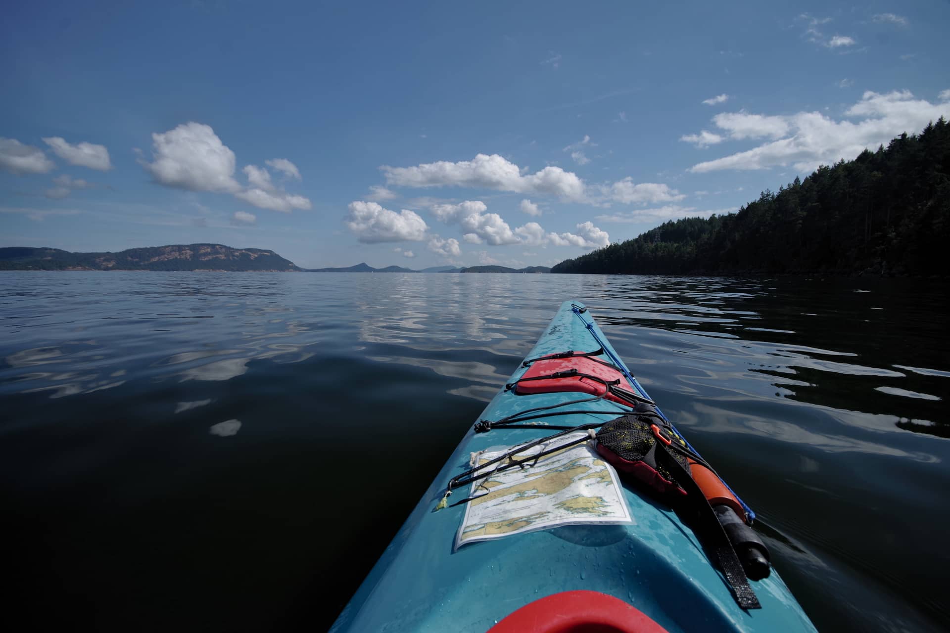
We continued our journey along Saltspring, hugging the coastline to avoid the tide that we knew would soon be flowing against us. The waters were calm and mirror-like, making easy paddling as we approach Prevost Island. From here we paddled across the short gap between Salt Spring and Prevost, crossing cautiously behind a passing ferry.
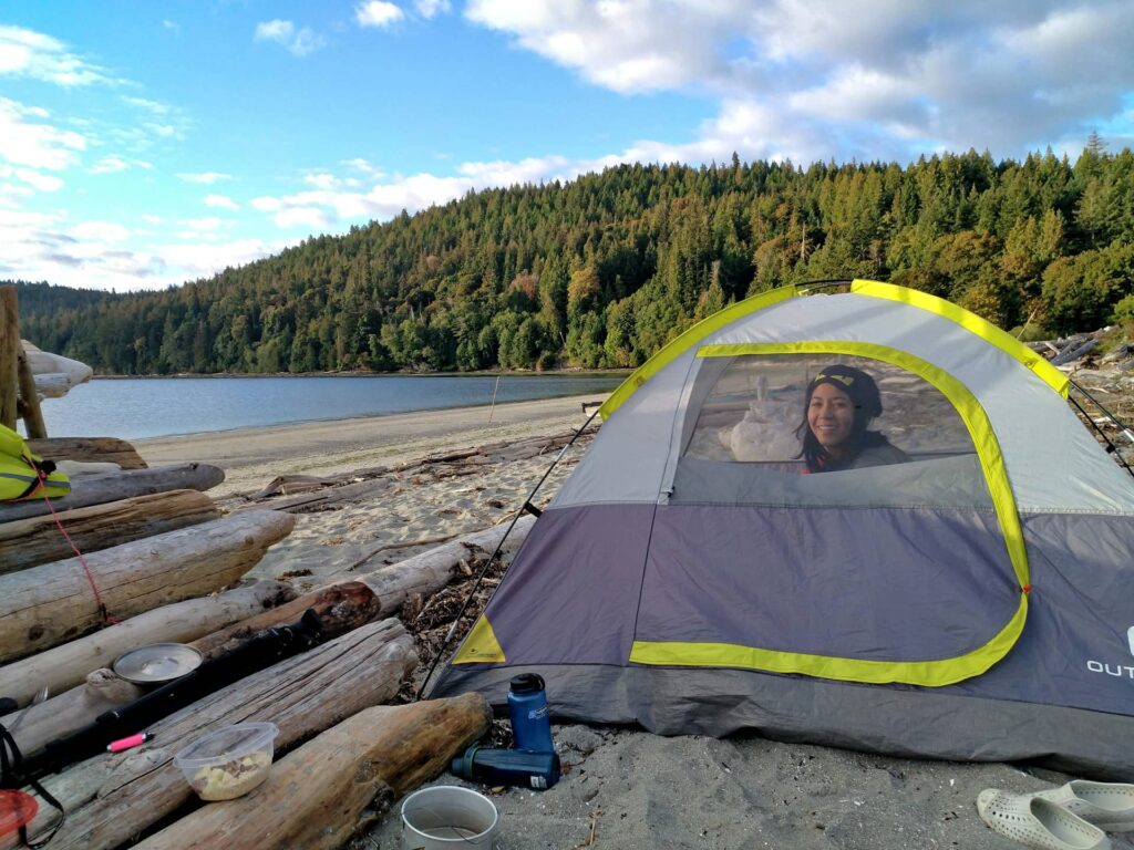
At about 5pm we paddled into James Bay campground, it’s sandy beach making an easy entrance for any level of paddler. We were amazed to see only one other tent at the campground, despite this being a bank holiday weekend! After pitching our tent we went back out for a quick lap of Prevost Island, before changing our minds a quarter of the way around. Instead we paddled back to camp for a beer.
Day 3: Prevost to Galiano + Galiano to Saltspring - 10km
On day three Jerome and I paddled back across the Montague Harbour, where he would catch an early ferry home, and be replaced by Ayelen who’d be joining me for the last night.
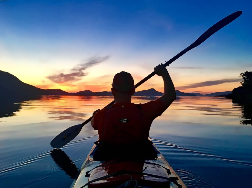
We woke up at 5am to pack up our tents, at which point it was still completely dark. Our shoulders were aching like crazy from levels of effort they just weren’t used to. The only thing I can compare it to is bad growing pains. We were motivated by the sunlight drooling over the horizon, and quickly jumped in our kayak to paddle across the bay. What we didn’t expect was possibly the most beautiful sunrise I’ve ever experienced, made more incredible by the mirror-like reflection on the water.
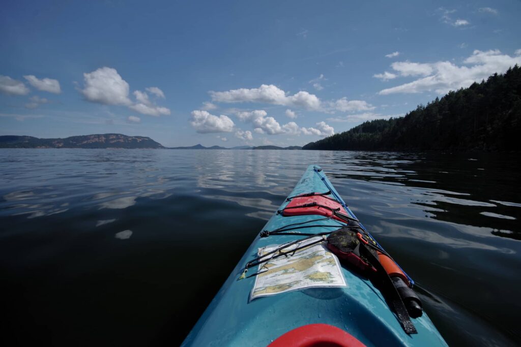
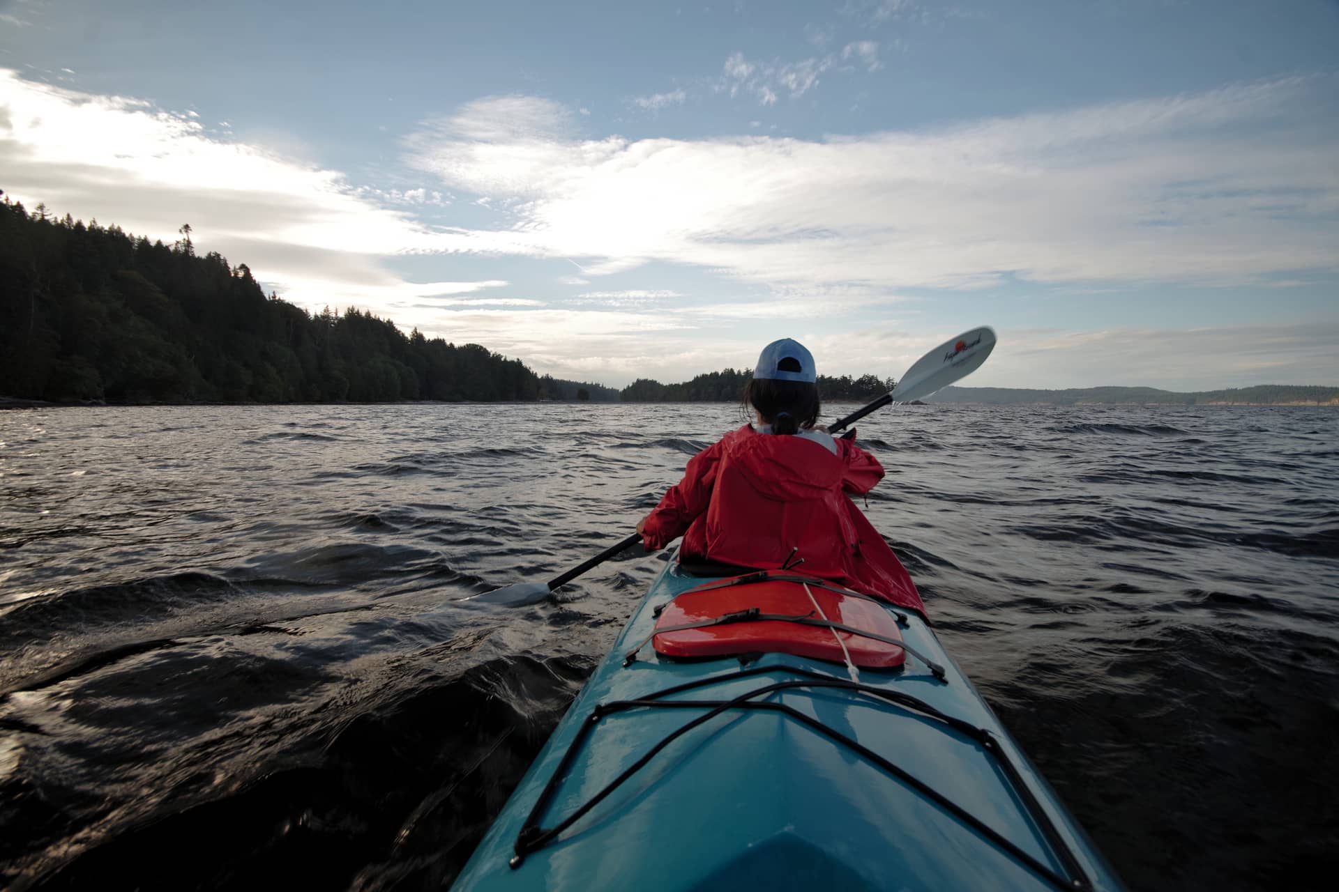
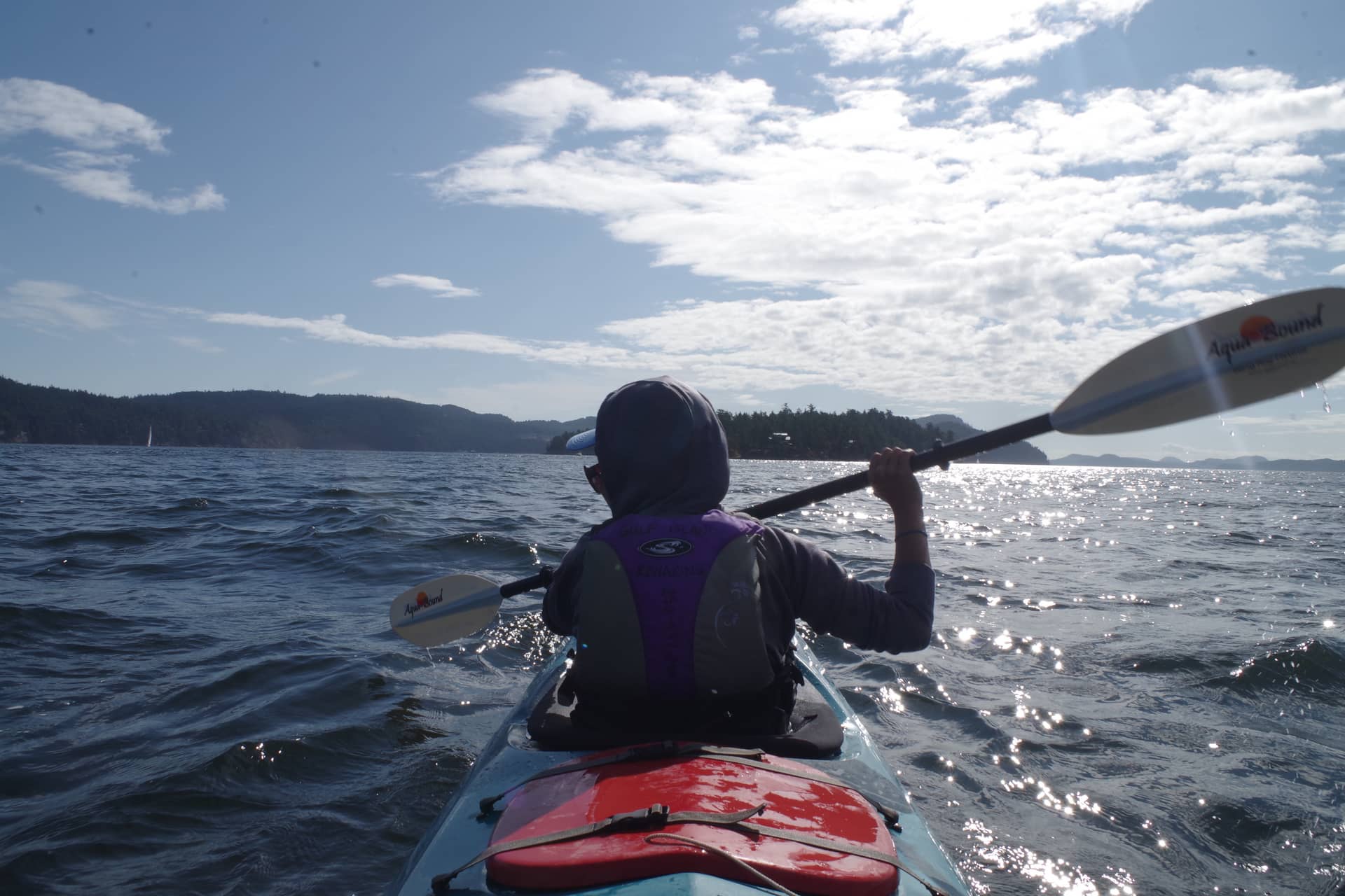
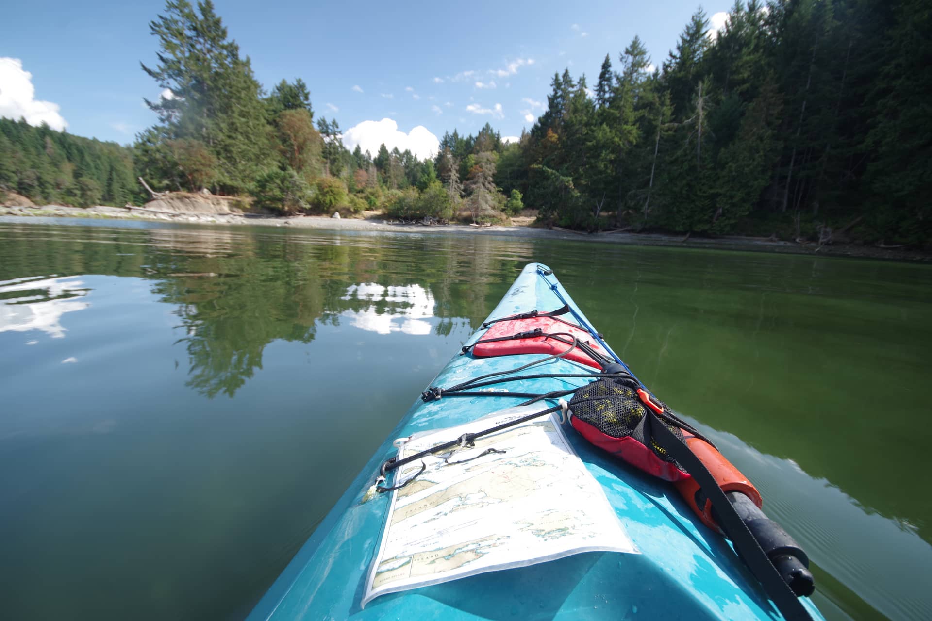
After swapping Jerome for Ayelen, we paddled back out onto the Trincomali channel into what was now a bigger swell than I’d hoped for. Fortunately the conditions calmed down pretty quick which gave us a good opportunity to cross. I stayed in the back to do the steering and Ayelen took the role of navigator with our map in the front. The great thing about sitting in the back is you always know when the person in front is slacking, and you can crack the whip!

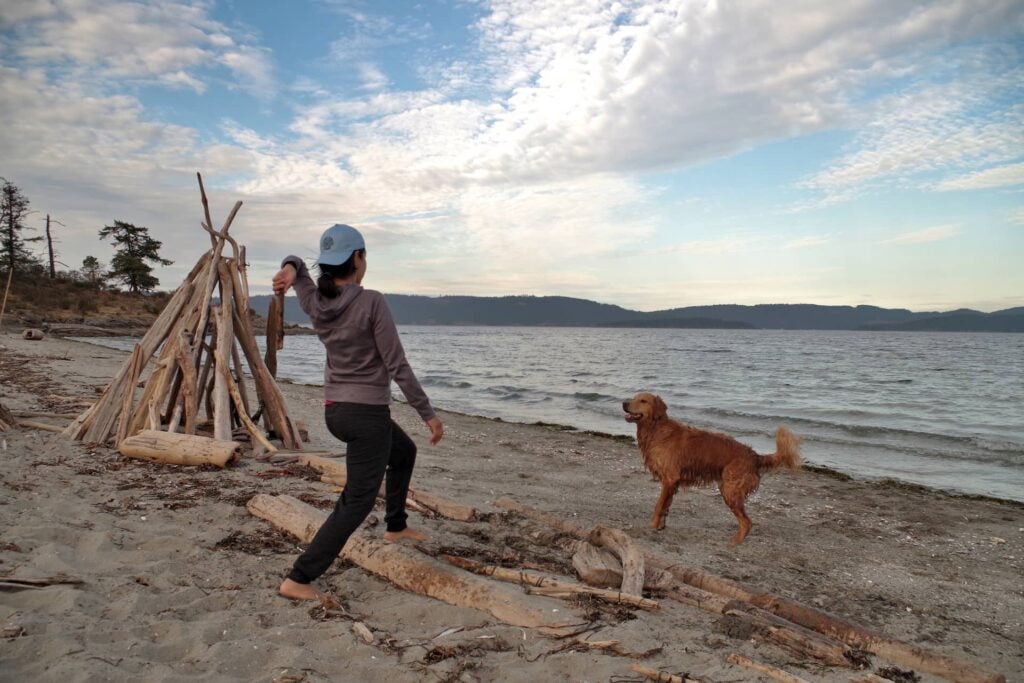
We could not have had a better experience of Walter Hook beach. Zero wind and calm waters made it another exceptional night to see the bio-luminescent plankton, and we even made a new friend along the way…
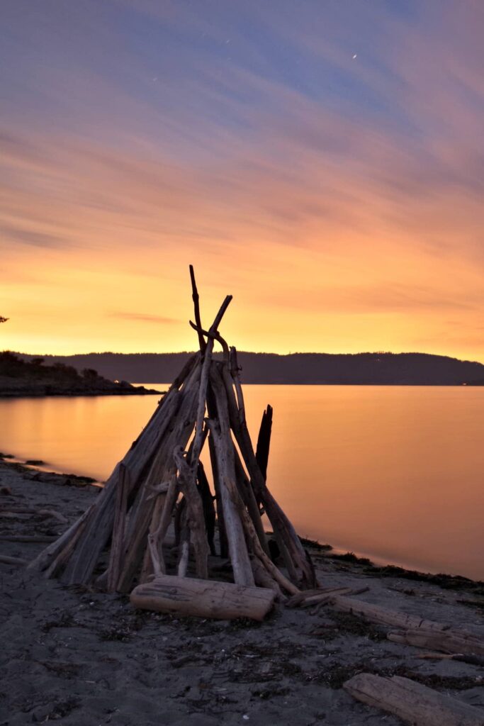

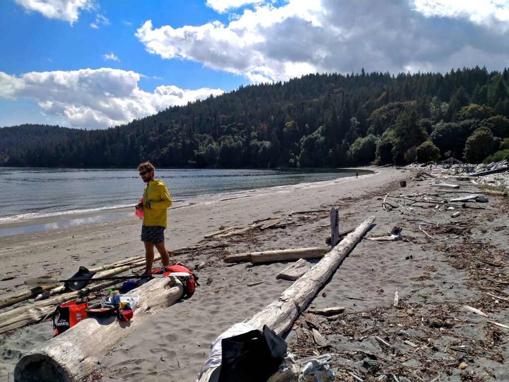
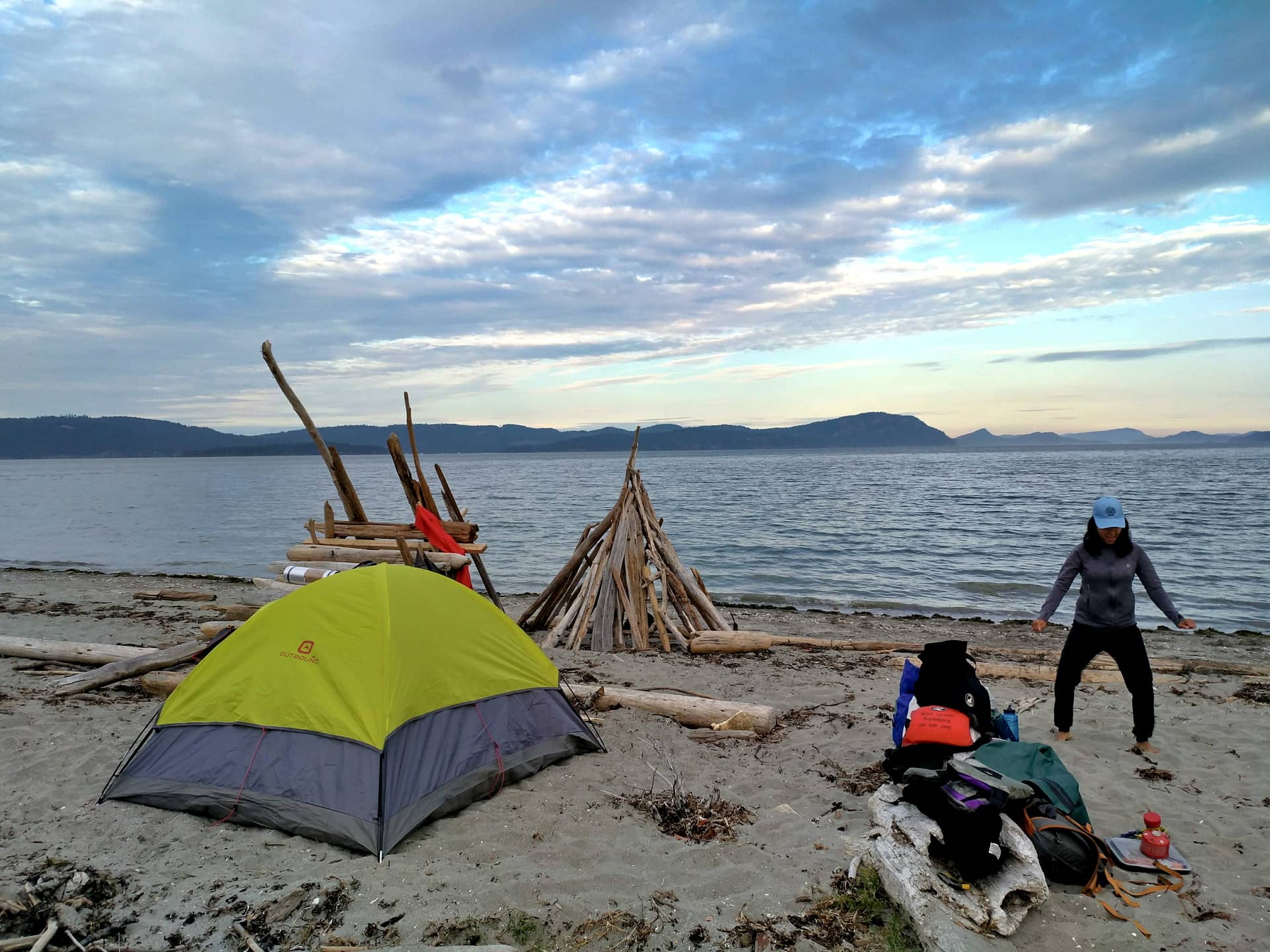
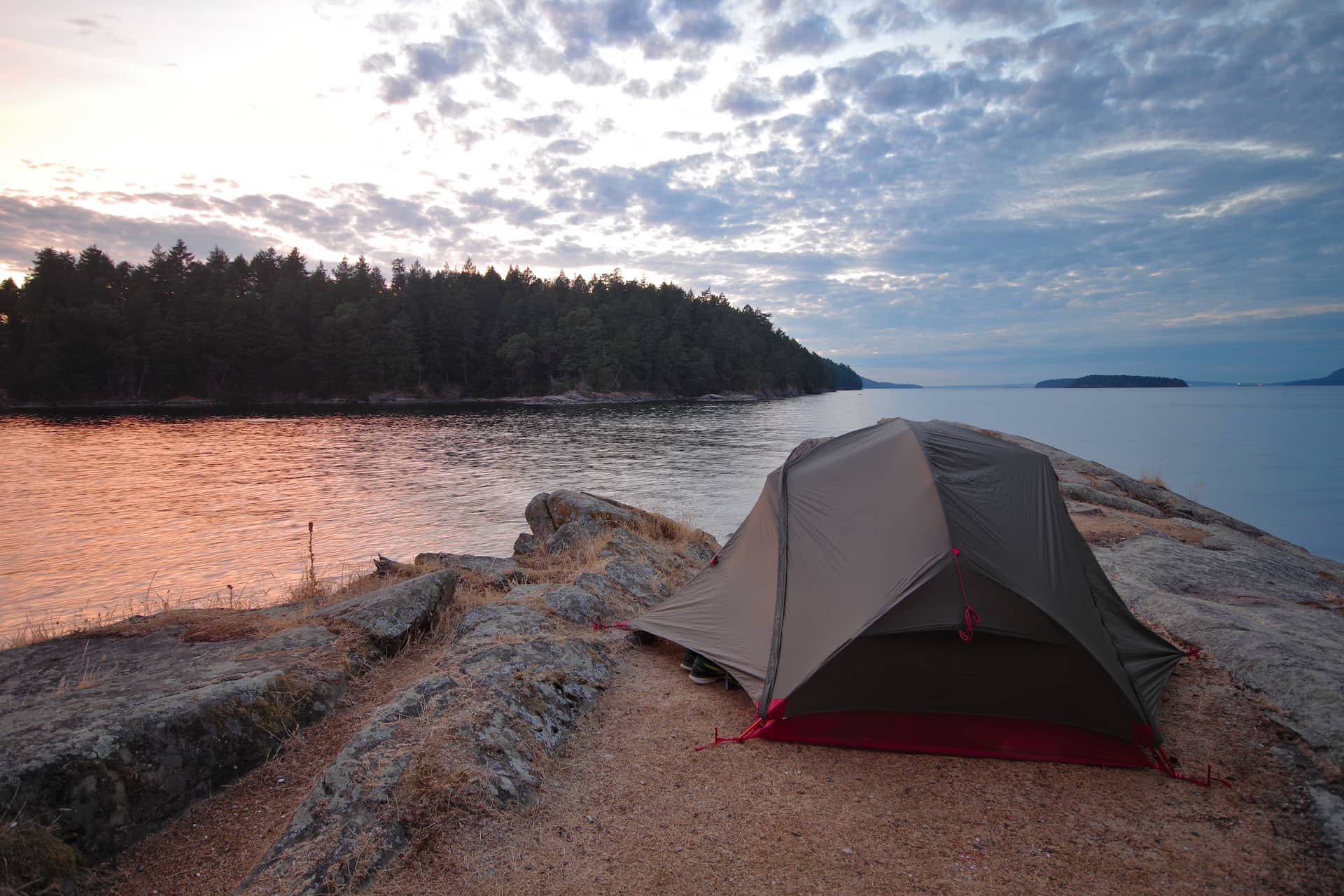
A Note on Beach Camping: Technically, all beaches are campable as long as you camp at or below the high tide line. This always seems like a bit of a debatable line to me, but in principle it means where all the logs get dumped on the beach by the highest of tides. We had a high tide at 11pm which filled the entire beach. We had to wait it out on the logs before pitching our tent. You may wonder why we couldn’t walk up onto the land behind the beach – which is because that land is private, and the farmer was there to make doubly sure that we know about it.
Day 4: Saltspring Island to Galiano Island
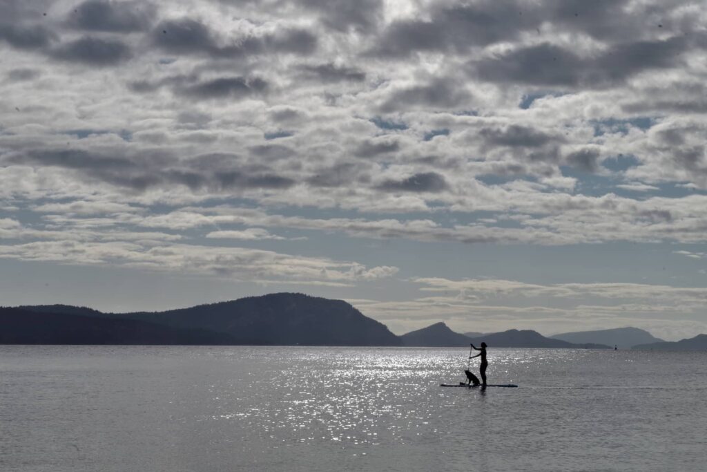
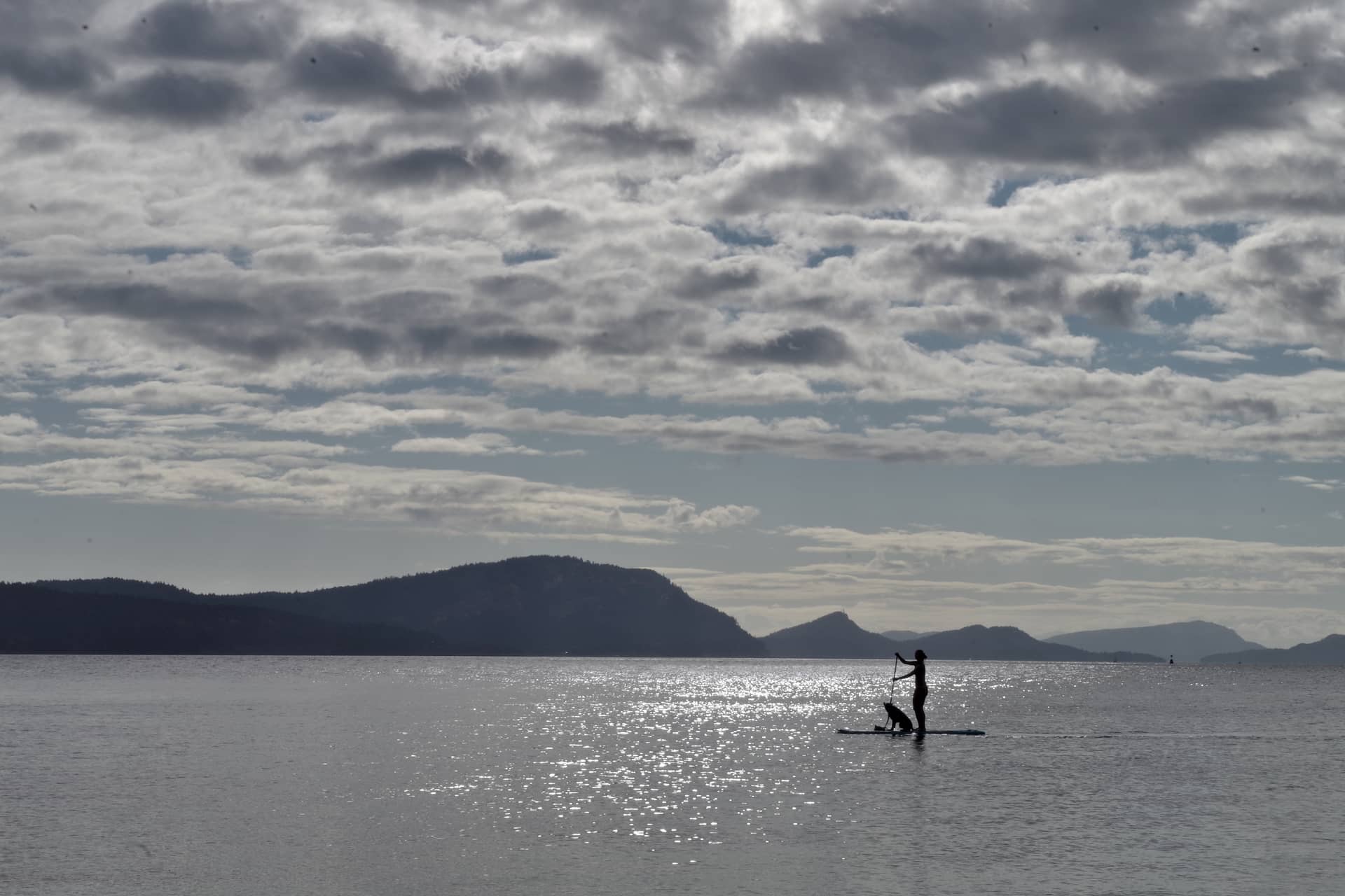
After a late start and a morning coffee, it was time to pack up and head back to Montague Harbour. Many logs on the beach make great wind shelters, though on this occasion as you can see there was almost none. Below you’ll see the stand up paddler and her dog that came by in the perfect morning conditions.
Ayelen was less reluctant about crossing the Trincomali Channel second time round. Conditions were calmer, and we were motivated by the thought of beers and fries at Montague Harbour. The journey back from Walter Hook beach took us about 2.5 hours, including a few detours to observe a couple of seal colonies and posh mansions from a distance.

So there you have it, our 4 day itinerary in and around the gulf islands. You absolutely do not have to follow the same path, and inf fact I would encourage you to look at the map of campsites, assess the conditions, your ability and your ambitions, and make a plan that suits you. Either way, stay safe and only tackle conditions and crossings you are capable of, and capable of rescuing yourself from.

Add Review