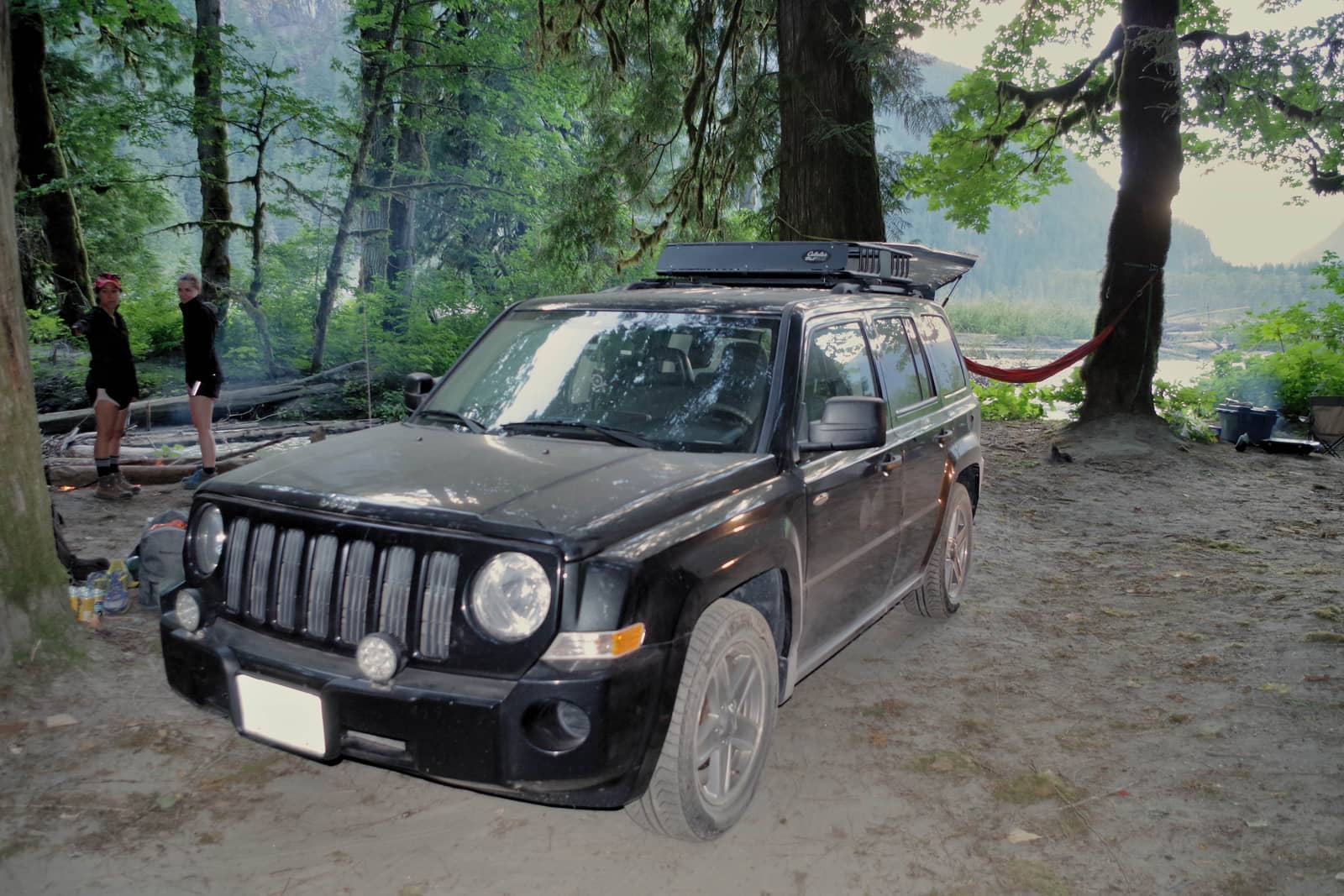
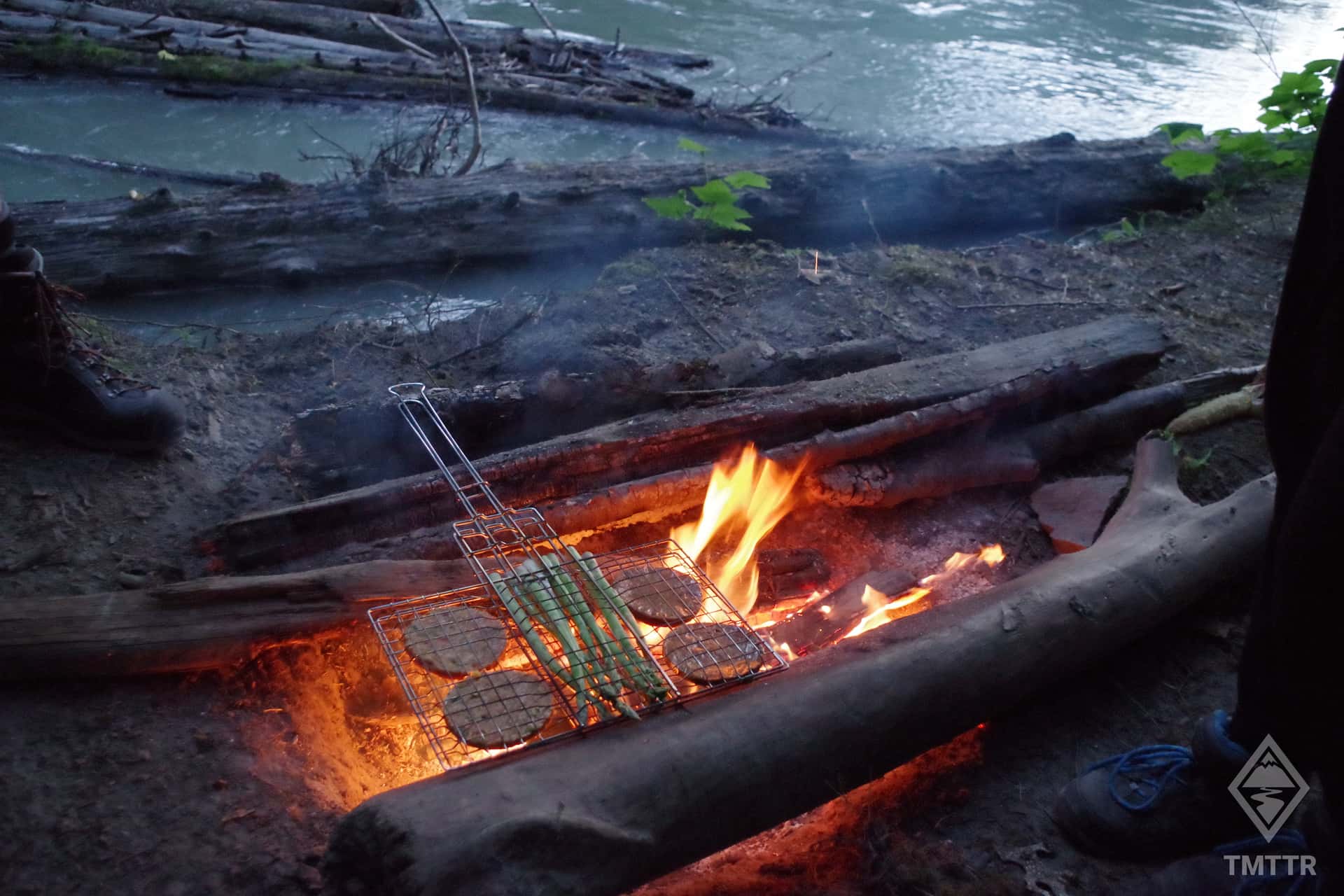
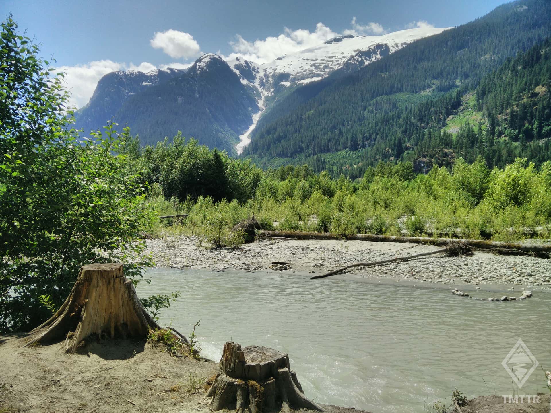
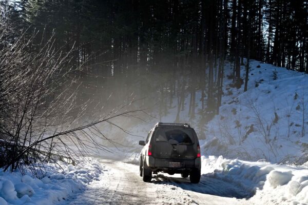
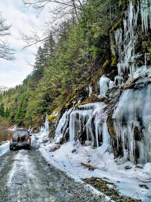
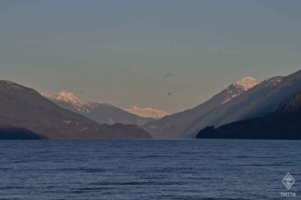
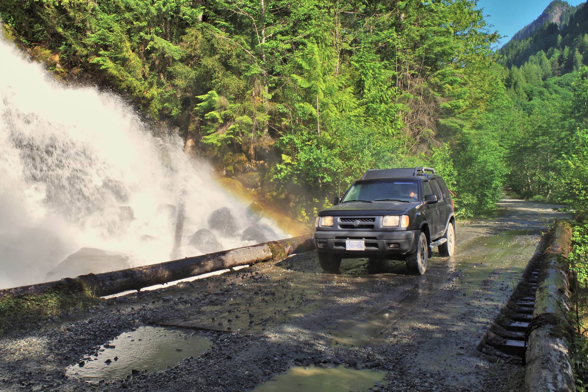
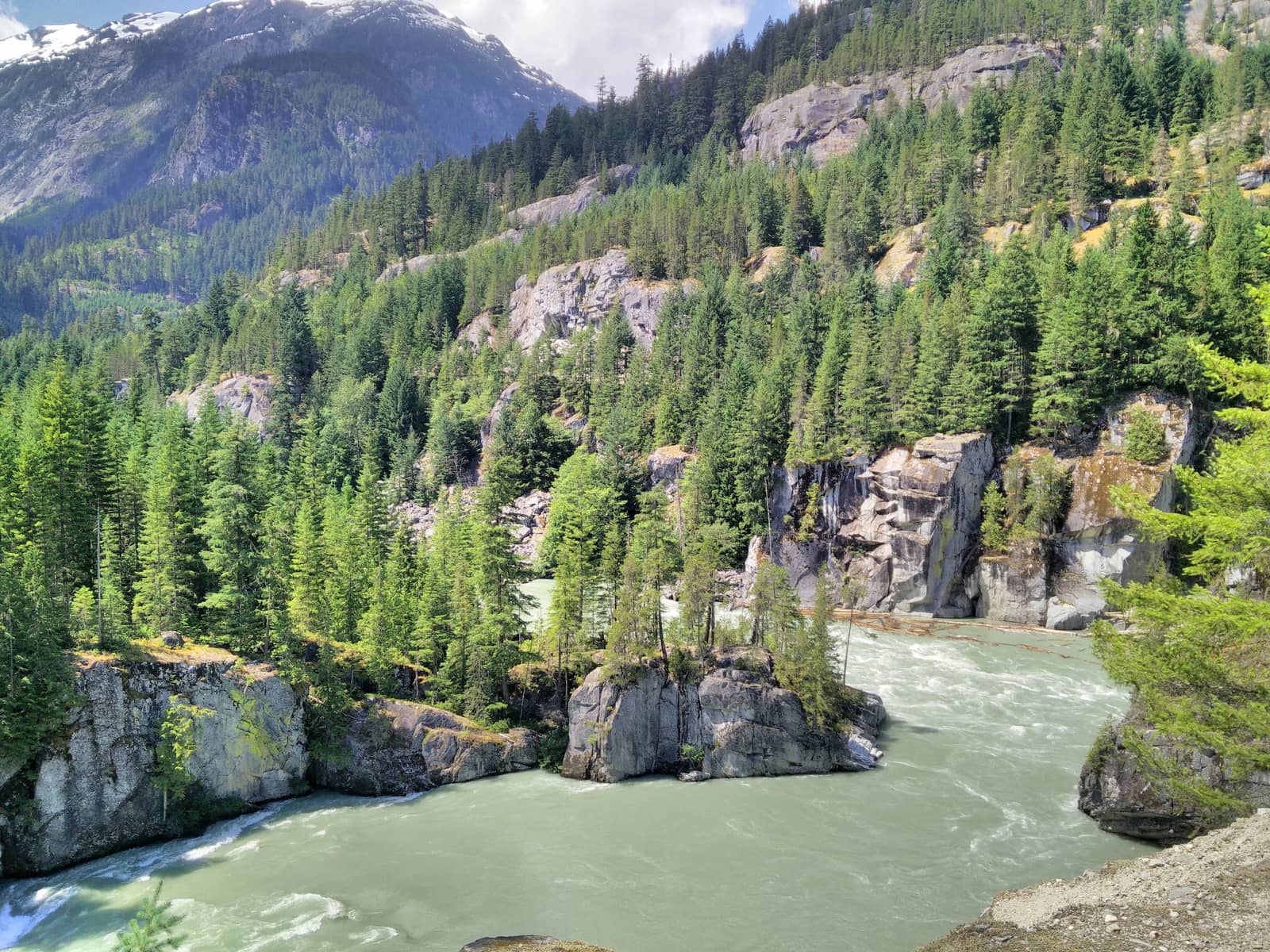
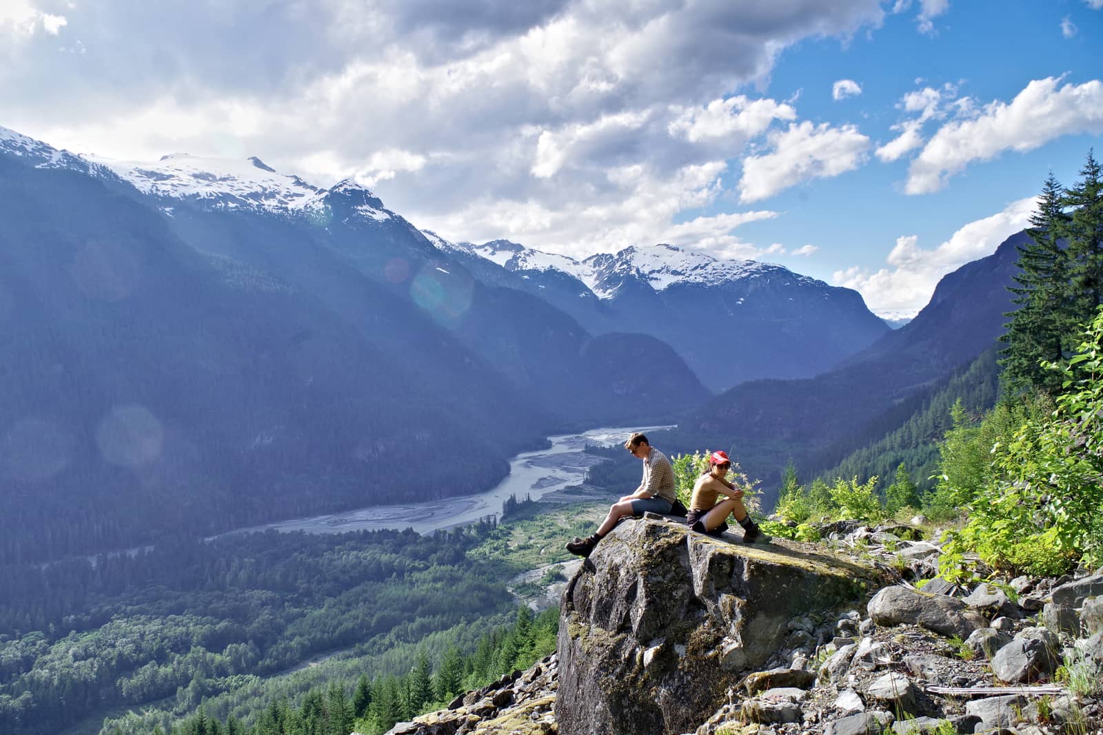
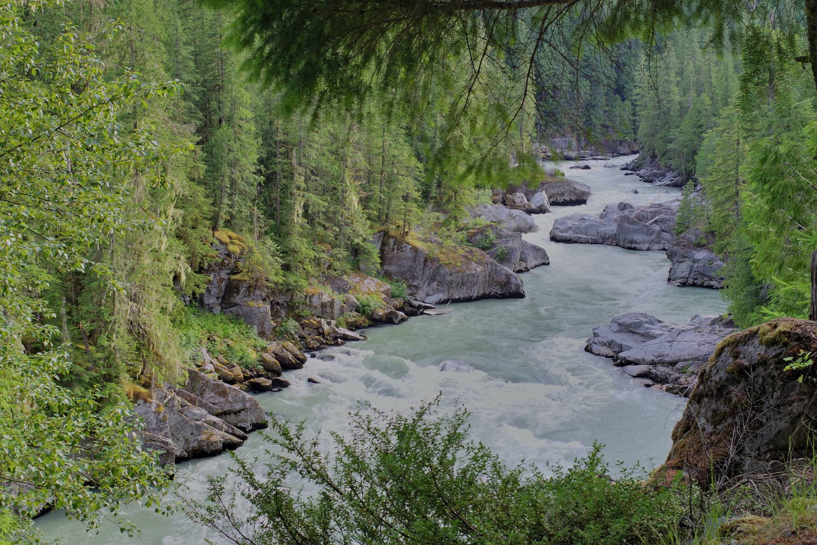
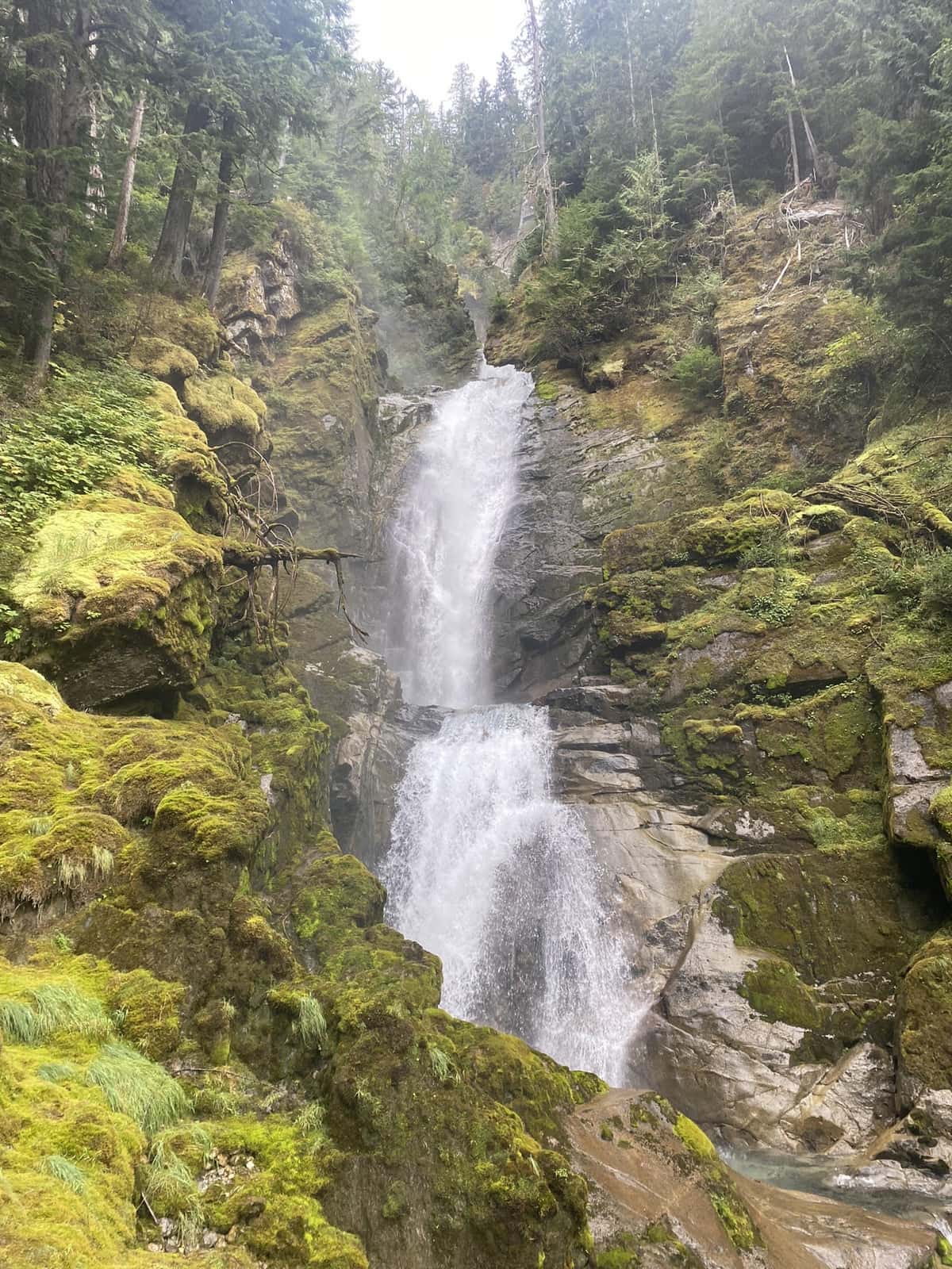
The Squamish River FSR provides easy access to the stunning Squamish Valley, with accessible campgrounds, hikes for all abilities and incredible views. It’s always top of my list when people ask for an easy way to get into backcountry driving and adventures. This backcountry itinerary is designed to be an easy introduction to the Forest Service Roads of BC. It’s easily passable without a high-clearance 4×4, and won’t take you more than 40km from Squamish.
This blog will give you everything you need to know to plan your weekend or day-trip, but do make sure you read my tips for backcountry adventures, linked below.
You’ll very quickly be met with jaw-dropping views of the Squamish River valley, as the road climbs and descends the meandering river banks. The road will change between gravel and tarmac initially before changing permanently to gravel, though is incredibly well maintained for a dirt/gravel road. After only a few kilometers on the gravel, you’ll lose your phone signal, though on most weekends there are plenty of other cars around that you can flag down should you need help.
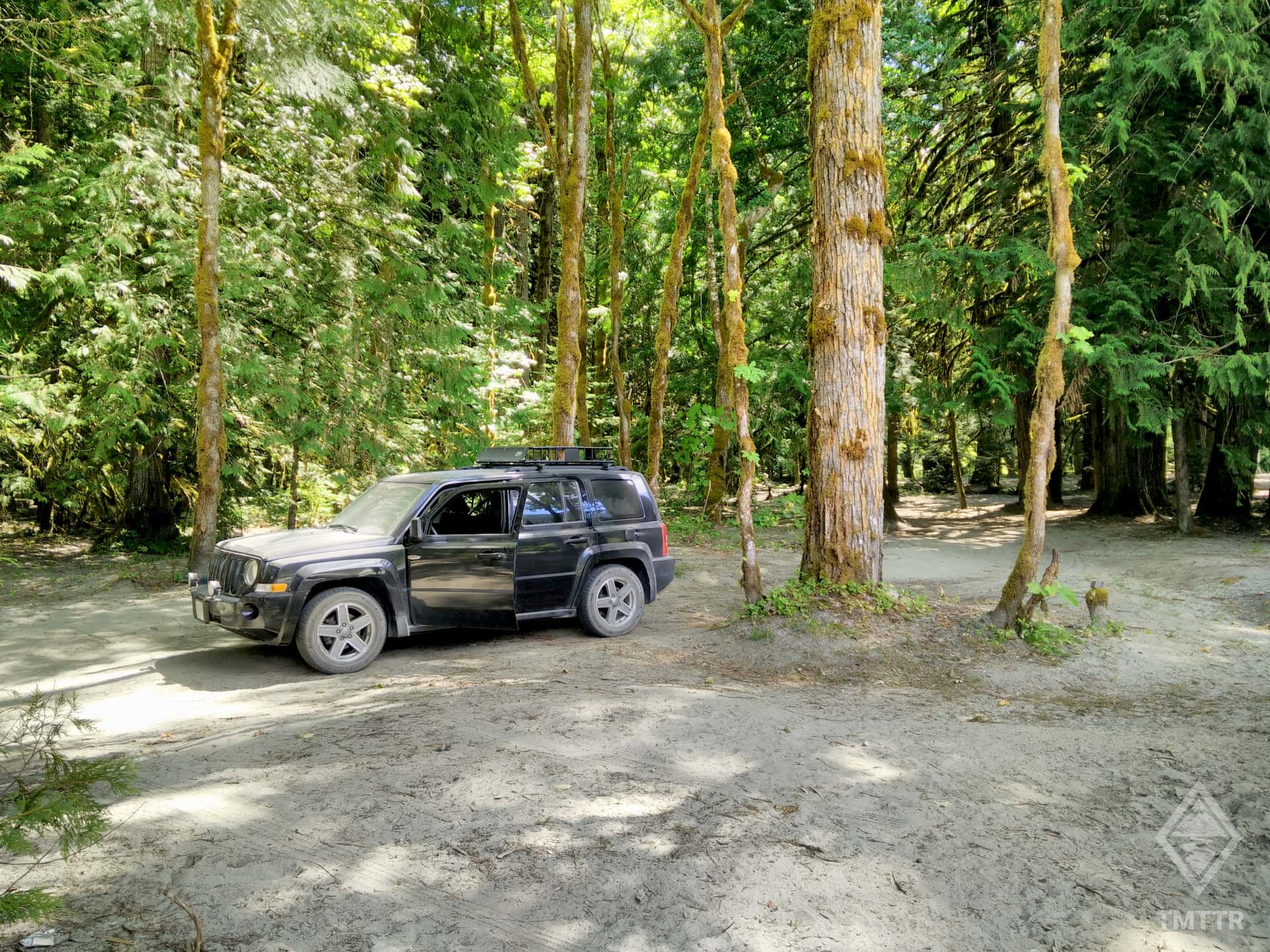
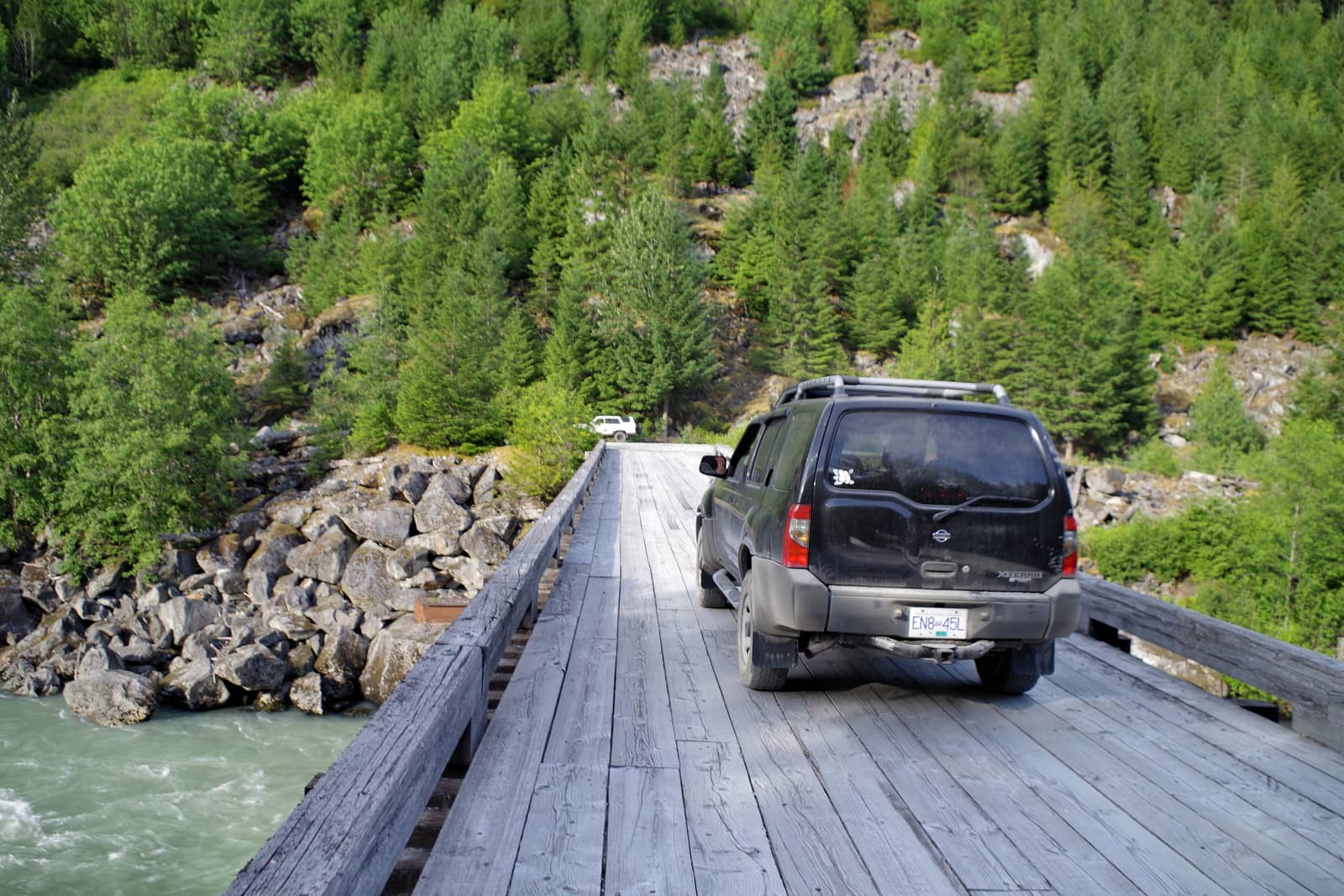
The Squamish River FSR, including High Falls Creek Trailhead, Campground and Crooked Falls Trailhead are all accessible with a regular 2 wheel drive car such as a VW Golf.
Driving further up towards Maude Fricket Falls is still passable in such a vehicle, but lookout for big rocks and note that conditions on FSR roads are constantly evolving as roads are not maintained to the same standards as paved highways.
The official BC Roads FSR Conditions Map describes this route as passable by 2wd but 4wd recommended.
Offline Maps & Map Books
Forest Service Roads can almost guarantee zero phone signal. You should have an offline electronic map available at the very least, and I highly recommend taking a paper map as a backup.
You can use Google Maps to download the relevant area, though other mapping apps like Gaia GPS are better for adventure-type activities and have much better backroad detail. You can download a GPX route for the Squamish Valley FSR here.
This is the paper map I like to have in my car for this trip. This particular map covers everything you’ll need to venture into the backcountry near Squamish, Vancouver and the coast. BRMB map books have a ridiculous amount of detail showing back-country roads, hot-springs, trailheads, waterfalls etc all around BC.
Whether you use this map or an electronic one, make sure you have some way of accessing a map without phone signal. Test it in airplane mode to see what happens when you have no signal.
Satellite Communication
When venturing down forest service roads, you are going quickly into the world of no phone signal. The realities of this quickly becomes apparent when you are 2hours into a hike, and a further hour drive from phone signal.
Personally, I made the decision to buy a Garmin Inreach Mini 2, which allows me to send texts using my phone, but via satellite. I can send regular updates to family and friends to let them know exactly where I am, and if I need help. It also allows me to press an SOS button that relays the request to Search & Rescue if that becomes necessary. It’s obviously a device I hope I’ll never use for its SOS functionality, but it definitely gives me peace of mind in the backcountry and far from phone signal.
Backcountry Driving in BC
If you’re new to backcountry driving and Forest Service Roads, you may want to check out my blog called A Guide to Backcountry Driving in BC, which has a ton of info on trip preparation, conditions, and a load of links to useful resources.
The Squamish River Forest Service Road extends north-west from Squamish. The road is accessible for most vehicles as far as 40km from the highway, making it a safe and accessible way to explore your first Forest Service Road.
From Vancouver, drive an hour north to Squamish along the Sea to Sky highway. The Sea to Sky is an added bonus on most Northbound adventures from Vancouver, often ranked as one of the best drives in the world. From here, use your map app to navigate to the Cheakamus Generating Station, which is approximately 1km beyond the start of the FSR.
Tip: When you change onto the Squamish FSR, remember, reset your trip odometer to aid navigation. Kilometer counters are marked at the side of the road as well as the direction (up or down) that you’re traveling (down means towards civilization; Squamish). If you ever get into trouble, these markers make good reference points.
If appropriate for the route, rent a car, or better still, reduce the demand for cars with Evo Car Share, Vancouver's car sharing network.
Km Marked: 1.1, Squamish FSR
The Squamish Valley Campground is a paid campground, offering a well-kept camp with basic facilities. Outhouses are provided, as well as access to a beach. I have never been to this camp, but it seems to be well rated on google. After driving along the Squamish Valley Road for a while through forest, you’ll reach a sharp right-hand turn with a view of the river on the left. From here you’ll find the campground a further 2km on the left side.
You can find the link to the Squamish Valley Campground website here, and directions on Google Maps here.
Km Marker: 5.5, Squamish FSR
High Falls Creek Rec Site is less than one kilometer past the High Falls Creek trailhead, which can easily be found and pinned on Google Maps (before you lose your data connection). It is clearly marked with the usual “recreation site” sign on the left side of the road. The campsite is free and usually pretty quiet. There are zero facilities here, just a lovely picturesque camping area by the river with no designated spots. Fires are permitted but do check for any province wide fire bans during summer months.
You can find the BC Rec Sites listing for High Falls Creek Rec Site here.
Located at Km Marker: 0.2, Ashlu Road (on the far side of the Ashlu FSR Bridge)
Squamish Riverside Rec, as the name suggests is right along the riverside. Take the Ashlu FSR bridge and then immediately turn right before crossing the next bridge. Apparently a popular spot for fishing. The site has no facilities and according to the official listing has a history of bear sightings. There is space for about 10 spots, though during busy weekends and summer this fills up quickly. We took our camper here for its first outing (a Ford E250) overnight and had a great nights sleep in the dark of the Squamish Valley. Access to the camp is fairly rugged and uneven, I probably wouldn’t take a low clearance vehicle here.
You can find the BC Rec Sites listing for the Squamish Riverside Rec Site here.
Located Km Marker: 26.5, Squamish River FSR
High Falls Creek Campsite is less than two kilometers past the High Falls Creek trailhead, which can easily be found and pinned on Google Maps (before you lose your data connection). The location of this post is the campsite itself. It is clearly marked with the usual “recreation site” sign. The campsite is free and usually pretty quiet. There are zero facilities here, just a lovely picturesque camping area with no designated spots. Fires are permitted but do check for any province wide fire bans during summer months. Set up camp here and then make your way to the trail head about 1 – 2 km before the campsite.
Squamish will be your last opportunity to stop for supplies and fuel. Your best option is Save On Foods, located about a kilometer from the main highway in Squamish, and near many other outdoor supplies shops. Once you’re all stocked up you’ll be head towards the Squamish FSR to the North West of the town.
When you change onto the Squamish FSR, remember, reset your trip odometer to aid navigation.
The hike involves some light scrambling with moderate exposure. Whilst you can try to stick to the less exposed side, the big drop to the creek below can be intimidating, especially for inexperienced scramblers. As the name suggests you’ll be following a steep creek and eventually reach an impressive waterfall. Beyond that you’ll be walking […]
Crooked Falls is a popular hike located on the southern banks of the Squamish Valley. With its shady forested trail, moderate stats and a rewarding cascading waterfall at the end, it’s a great option for a hot summer’s day – particularly if you want to be hit by a refreshing wall of spray. The trail […]
After waking up and realising what an awesome decision you made to camp down an FSR, you’ve got a few options for your second day, depending on how tired you are from the previous day’s hike (or perhaps how many beers you drank the evening before).
To get back to Vancouver you’ll drive the same route in reverse, back along the Sea to Sky highway. It’s worth knowing that Sunday evening traffic back into Vancouver from the North is particularly bad. You can often be queued up for a couple of hours as the traffic squeezes across the less than adequate two bridges to the lower mainland. I’ve learnt my lesson too many times so tend to stop for dinner or a beer in Squamish at one of the following:
Alternatively, stop at Porteau Cove to admire the sunset, and allow the highway madness to pass before continuing on your journey. Be sure to check out the Sea To Sky Highway blog and make the most of your journey home.
Reach out with your questions!
Subscribe to download this content!
Evo is a car share program which operates in both Vancouver and Victoria. They help reduce car ownership and encourage car sharing. Whether you live in BC or are visiting from abroad, Evo is a great way to get around with minimal fuss. Their cars are even equipped with bike and ski racks if you’re heading to the mountains!
The below promo code will give you $25 free driving credit and earn me a small referral fee to help me maintain this website.
Add Review